FOXBYTE develops VR platform for Connected Urban Twin Hamburg
This will be realized through the innovative work of our colleagues at FOXBYTE. In the coming months, we will develop a VR platform that will serve as the central element of the networked Connected Urban Twin Hamburg. The platform will be available as open source and could become the basis for a Germany-wide standard.
From first contact to collaboration
It all started at the XR Expo in Fellbach in April 2024, where we first crossed paths with the Hamburg State Office for Geoinformation and Surveying (LGV). The city of Hamburg, known for its pioneering role in IT-based city applications and 3D visualization, is pursuing a groundbreaking project as part of the Connected Urban Twin initiative: the development of a VR platform for Hamburg.
Thanks to our Unity expertise in real-time 3D and VR, as well as our competence in backend connectivity and web software development, FOXBYTE is helping to make the vision become reality.
Since November 2024 we have been working on the technical system architecture, the user experience (UX) and the user interface (UI) of the native Unity application.
A tool with national potential
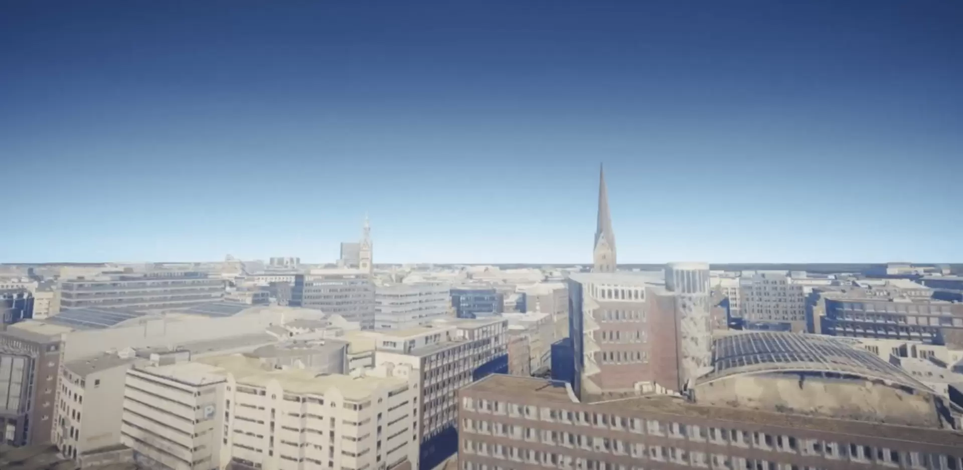
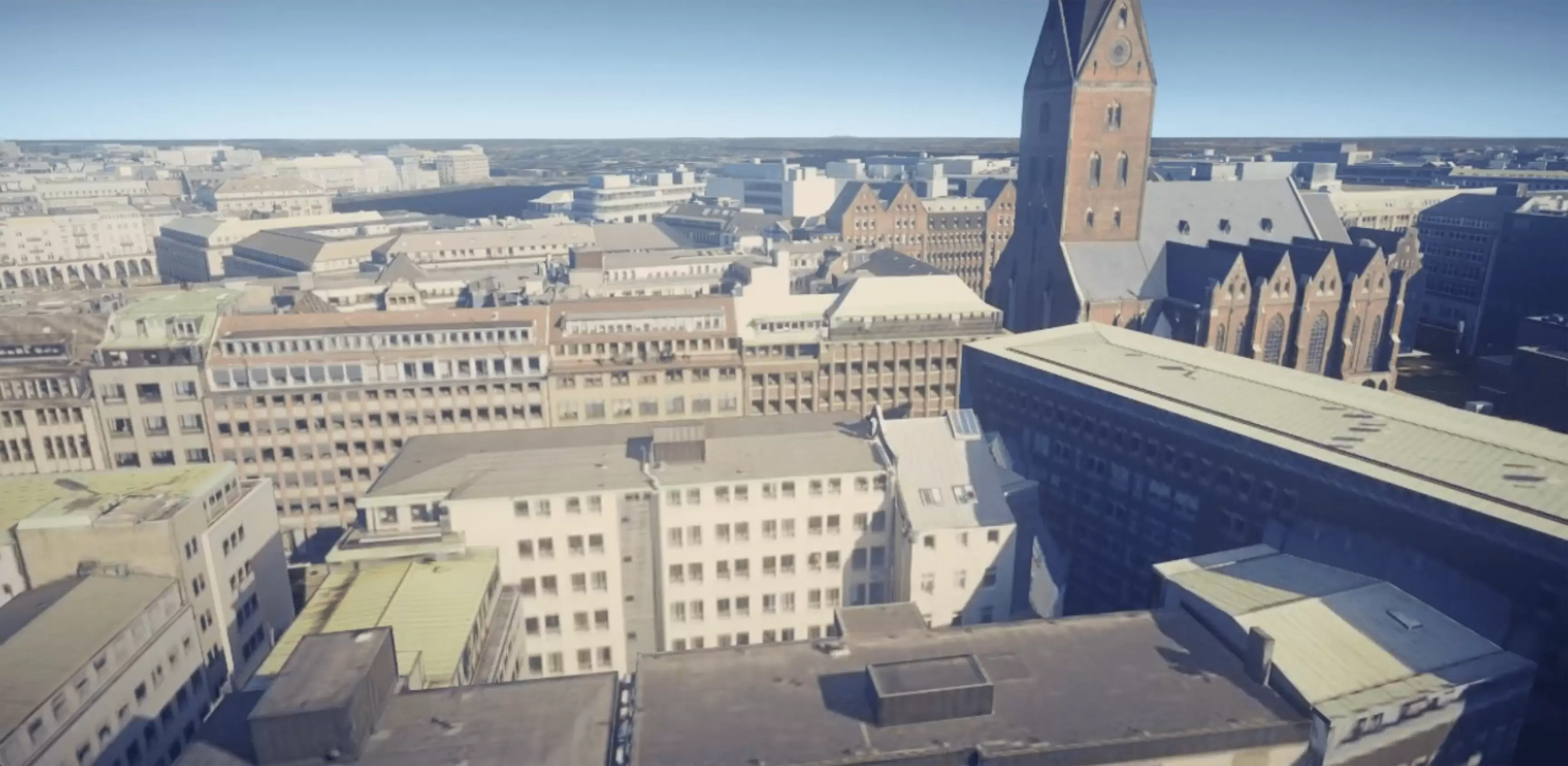
The Connected Urban Twin Initiative, a network of Hamburg, Leipzig and Munich, is pursuing an open-source strategy. The goal: a VR platform that not only depicts Hamburg, but can be used throughout Germany by public authorities, companies and private individuals. With a public resolution of 20 centimeters, and even 5 centimeters for city planners or architects, the platform offers insights down to the smallest detail.
The digital image of Hamburg serves as a basis for modern, integrated urban development and sustainable urban spaces. It enables "what-if" scenarios, for example for emergency simulations or urban planning. At the same time, it promotes citizen participation through transparent planning processes.
Computing and high-performance virtual worlds
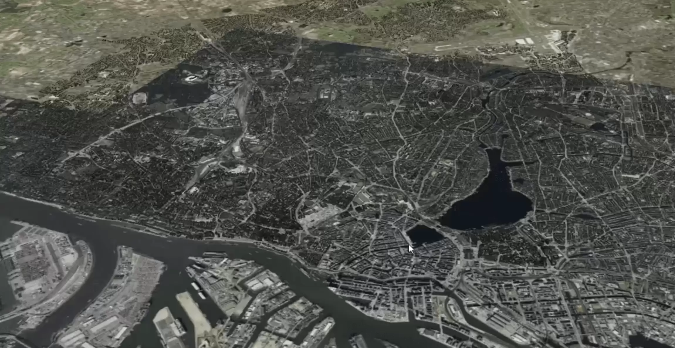
In order for the VR platform of the Connected Urban Twin Hamburg to provide a realistic and immersive experience, high-performance data processing is essential. The city's high-resolution geospatial data must be efficiently processed and rendered in real time to ensure a smooth VR experience.
A key element is the high-performance streaming of large volumes of 3D data. The detailed models of buildings, streets and trees require advanced geometry optimization algorithms to keep the computational load low without compromising visual quality. At the same time, dynamic data such as traffic information or sensor data from the city must be seamlessly integrated into the virtual world.
Especially in virtual reality, a high refresh rate is essential for a smooth and comfortable user experience. Stuttering or delays can not only affect the realism of the simulation but also increase the risk of motion sickness. That's why we rely on state-of-the-art rendering technologies, level-of-detail strategies, and cloud-based data processing to optimize the balance between detail and performance.
The combination of precise data integration and intelligent performance optimization makes the VR platform a powerful tool for city planners, businesses and citizens. The result is a virtual twin that is not only informative, but also intuitive to experience.
With years of experience in visualization and data processing, FOXBYTE is the ideal partner for this ambitious project. We have been working on innovative 3D and real-time applications for years and have mastered the complex processing of large amounts of data to seamlessly transform it into powerful, interactive experiences.
Looking Ahead
In the current phase, we are integrating building and land data, as well as tree registries. In the medium term, other information such as city bike stations, e-charging stations and real-time traffic data will be added.
The project has the potential to become a German-wide standard for digital city twins, and we are proud to be paving the way with our expertise in Unity and VR.